

Focusing on Climate Adaptation and Resilient Cities:
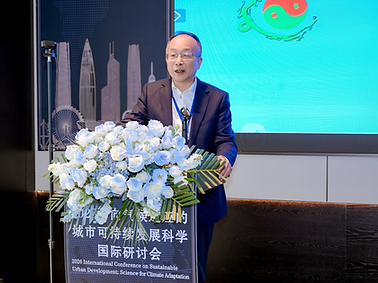
2026 International Conference on Sustainable Urban Development: Science for Climate Adaptation
Held in Shenzhen
From January 5 to 6, 2026, the “2026 International Conference on Sustainable Urban Development: Science for Climate Adaptation” was successfully held in Shenzhen, Guangdong. The event was hosted by the Sustainability X-Lab at the University of Hong Kong (HKU) and co-organized by the School of Earth System Science at Tianjin University, the School of Urban Planning and Design at Peking University, the HKU Shenzhen Institute, and the City University of Hong Kong Shenzhen Research Institute.
This conference brought together top minds in the field of sustainable development. Distinguished attendees included Academician Congqiang Liu of the Chinese Academy of Sciences (CAS), Academician Anthony Yeh of CAS, Academician Chuanglin Fang of the International Eurasian Academy of Sciences, Vice-Chancellor Peng Gong of The University of Hong Kong, Academician Yansui Liu of The World Academy of Sciences (TWAS), Academician Pengjun Zhao of the Academy of Social Sciences (UK), and nearly a hundred experts and scholars specializing in sustainability science. The conference was chaired by Professor Xiaoling Zhang of the Department of Real Estate and Construction, Faculty of Architecture, The University of Hong Kong, and Director of the Sustainability X-Lab.

Professor Peng Gong, Vice-President of HKU, announced the opening of the conference. In his welcome address, he emphasized that climate change has evolved into a severe and pressing challenge for human societal development. Exploring a sustainable development path with climate resilience is not only a cutting-edge scientific issue but also an urgent historical task. He sincerely welcomed all guests to contribute new scientific insights, technological ideas, and decision-making references for urban actions to address climate change, and called for the establishment of a systematic urban science system to support climate adaptation-centric urban sustainable development. Looking ahead, Vice-President Gong stated that future research will inevitably be built on a global, quantitative, intelligent, and virtual-real integrated multi-institutional cooperation platform. He expressed anticipation that all colleagues will contribute valuable intellectual resources to building more systematic, safe, green, livable, and inclusive resilient cities.
Professor Xiaoling Zhang extended a warm welcome to the participants once again and further elaborated on the academic background and core themes of the conference. Drawing on the research vision of the 2025 National Natural Science Foundation of China (NSFC)-SDIC project "Dynamics and Sustainable Development of Social-Ecological Systems in Coastal Cities," she pointed out that as the most economically dynamic regions globally, coastal cities are at the forefront of land-sea interactions. They face severe challenges from the interweaving of intensive human activities and compound natural disaster risks such as sea-level rise and extreme storms. She emphasized that this seminar and related projects aim to provide solid scientific support and an "East Asian Solution" in response to China's national strategy for building climate-resilient cities.
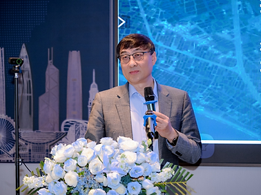
Subsequently, nearly thirty experts and scholars from Tsinghua University, Peking University, The University of Hong Kong, the CAS, and other institutions delivered keynote reports around the theme of "Sustainable Urban Development: Science for Climate Adaptation," offering cutting-edge scientific perspectives on addressing climate change and promoting urban sustainable development.

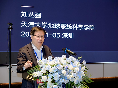
Academician Congqiang Liu delivered a keynote report, noting that human activities have propelled the Earth into the "Anthropocene," triggering multiple crises including climate and ecological disruptions. In response, he proposed a novel theoretical framework for Earth System Science and Engineering. Academician Liu emphasized that addressing global change requires more than just scientific understanding; it demands proactive intervention through engineering means. He advocated for a dual strategy of mitigation and adaptation, leveraging technologies such as energy decarbonization and ecological restoration to transform humans from passive adapters into active managers of the Earth system, thereby achieving global sustainable development.
Director Gao Yang from the Department of Earth Sciences at the National Natural Science Foundation of China provided an authoritative interpretation of the fund's support system and disciplinary development. He conducted an in-depth analysis of the latest reform initiatives and optimization directions of the natural science fund's review system, and comprehensively reviewed the funding landscape based on big data from the 2025 scientific fund applications and evaluations. Focusing on the cutting-edge field of "sustainable urban development science," he not only outlined future priority funding layouts but also offered highly actionable application guidance and key considerations for researchers in terms of refining scientific questions and integrating interdisciplinary approaches, encouraging scholars to identify critical scientific breakthroughs aligned with national major needs.


Professor Dabo Guan, Vice President of the Tsinghua University Institute for Carbon Neutrality, focused on the refined carbon accounting of global high-energy-consuming facilities and technical decarbonization pathways. He pointed out that in the context of carbon neutrality, China urgently needs to establish a global industrial carbon emission inventory with independent intellectual property rights to secure data sovereignty in future emission reduction responsibility allocation. Professor Guan detailed the facility-level data accumulation of the CEADs database in key industries such as steel, cement, and oil refining, emphasizing the necessity of transitioning carbon accounting from "regional total volume" to "facility scale." He proposed a process-based "one factory, one policy" precise decarbonization strategy, designing feasible technology-driven emission reduction pathways for high-energy-consuming industries by analyzing the service life, technological processes, and technical maturity of global facilities. He also envisioned the construction of an "energy-carbon intelligent connection" and a global three-dimensional carbon flux monitoring network.
Researcher Weiqi Zhou from the Research Center for Eco-Environmental Sciences, CAS, shared research practices and insights on long-term urban ecosystem observation. He emphasized that cities are typical complex adaptive "social-ecological" systems, and understanding the coupling mechanism between humans and nature is key to solving urban environmental problems. Researcher Zhou elaborated on the development process of national urban ecological station observation technical specifications, constructing a unified observation indicator system covering water, soil, air, biology, and human activities to address the historical challenges of inconsistent observation methods and poor data comparability. He proposed a "1+X+Y" urban ecological observation network layout model and advocated for the use of AI and big data technologies to transform observation methods from traditional manual approaches to intelligent, "space-air-ground" integrated monitoring. This transformation aims to obtain high-quality long-term continuous data to support the construction of livable, resilient, and smart cities.


Professor Zhifeng Wu from the School of Geography and Remote Sensing at Guangzhou University started from the perspective of "cities as natural–economic–social complex systems" to review the progress and bottlenecks of urban remote sensing in terms of scale, perspective, and multi-source information. He proposed an upgrade path from "remote sensing – ubiquitous urban sensing – urban cognition": integrating remote sensing, IoT, and socio-economic big data to transform signals into semantic and knowledge systems, thereby supporting urban decision-making oriented toward climate adaptation, resilience, and equity.
Researcher Fang Chen from the Aerospace Information Research Institute, CAS, delivered a report focusing on space-based Earth science observation, sustainable development science satellites, and understanding sustainable development in high-mountain Asia. He introduced China’s Earth observation system and the multi-level research framework for Earth big data, highlighting the capabilities and applications of SDGSAT-1 in integrated day–night imaging and open data sharing. The satellite supports urban sustainable development assessment, disaster process monitoring, and SDG synergy–tradeoff analysis, providing a data foundation for climate adaptation actions.


Professor Bindong Sun from the School of Public Affairs at Zhejiang University took 19 Chinese urban agglomerations as examples and used the population Herfindahl–Hirschman Index (HHI) to characterize monocentricity. He constructed a panel regression model to evaluate the impact of spatial structure on industrial soot (dust) emissions per unit of output. The study found that more monocentric urban agglomerations tend to have lower industrial pollution emissions—a conclusion that remains robust after testing with multiple alternative indicators and datasets. Potential mechanisms may involve stronger environmental regulations, the exit of polluting enterprises, and economies of scale in pollution control. Tailored spatial governance recommendations were proposed accordingly.
Researcher Jiaoe Wang from the Institute of Geographic Sciences and Natural Resources Research, CAS, expanded the concept of transportation resilience from "facility/network recovery" to "people-oriented travel resilience." She proposed a conceptual model and a disturbance classification framework from a supply–demand coupling perspective. Drawing on empirical studies of pandemic and extreme weather events, the report revealed significant heterogeneity in travel across time, space, and population groups: during disruptions, travel tends to shift toward familiar locations and repetitive routes, while different groups exhibit varying recovery speeds and priorities. This provides an operational analytical framework for resilient transportation governance and resource allocation.


Professor Kun Yang from Yunnan Normal University pointed out that, within the unified spatiotemporal framework of RS–GIS–GNSS and empowered by big data/AI, geographical research is transitioning from "element–process analysis" to a spatiotemporal intelligence paradigm of "holistic system cognition and simulation." The report proposed integrating data through local knowledge bases, advancing multi-model collaborative simulation via Model Context Protocol (MCP), and enabling iterative knowledge updates through Retrieval-Augmented Generation (RAG). This establishes an integrated "data–model–knowledge" framework to serve prediction, early warning, and sustainable development decision-making.
Professor Hucai Zhang from Yunnan University approached the topic from a global change perspective, focusing on the compound risks facing the plateau city of Kunming: prolonged drought intensification, extreme rainfall-induced waterlogging, combined with declining regulation capacity of Dianchi Lake and land subsidence risks due to groundwater level changes. The report emphasized that climate-adaptive cities must shift from "post-event troubleshooting" to "pre-event error prevention," promoting coordinated efforts across key pillars such as planning and layout, infrastructure, ecological restoration, and sponge city development. An adaptation agenda toward 2035 was outlined, including deepening mechanism research and constructing big data platforms.

Professor Yuqi Lu from the School of Geographical Sciences, Nanjing Normal University delivered a keynote lecture on “Lösch-Type Numbers and Central Place Configuration Patterns”. By extending the conventional K value to K(6n+1), his study established a closed theoretical framework with 18 spatial patterns. Empirical results show China’s provincial administrative structure matches the K13 fundamental number, extending the framework’s applicability to Eurasia; the proposed K13+K4+K3 composite pattern also explains China’s provincial-scale urban spatial configuration, filling a gap in the K-value spectrum for regional spatial planning.
Professor Gang Zeng, Director of the Institute for Urban Development, East China Normal University, interpreted Shanghai’s transition under the “dual carbon” goals. As an early adopter of the 2025 carbon peaking target, Shanghai has built a policy framework based on eight core initiatives. Empirical data confirm the city achieved simultaneous reductions in energy and carbon intensity while maintaining high-quality growth, verifying the compatibility of green transformation and economic development. He further suggested strengthening green tech innovation and regional cooperation to advance Shanghai’s low-carbon demonstration zone construction.


Professor Yanwei Chai from the College of Urban and Environmental Sciences, Peking University delivered a keynote address on “Spatio-temporal Behavioral Interaction Theory”, proposing a novel theoretical paradigm for urban sustainable development. To clarify the environmental-human behavioral coupling mechanism, he integrated behavioral science and time geography to build a multi-dimensional framework covering subjective-objective dimensions, short-long-term processes and multi-actor interactions. Empirical analyses of emotional ecology, commuting and residential mobility proved the framework’s explanatory power, providing a scientific basis for precise spatial governance and low-carbon behavioral guidance.
Professor Suhong Zhou from the School of Geography and Planning, Sun Yat-sen University presented “Environment, Health, and Governance through Time–Space–Human Coupling: Framework and Applications”. She proposed an innovative theoretical framework for environmental health intelligent governance, integrating dynamic temporal sensing, spatial identification and human-centered exposure assessment . Supported by multi-source data and AI, her team’s Guangzhou-based empirical studies identified environmental health high-risk areas, advancing an integrated governance model to inform targeted policy-making.


Professor Manchun Li, Director of the Institute of Spatio-temporal Information and Territorial Spatial Governance, Nanjing University, shared advances in digital land-type mapping. He noted land types reflect natural-human system interactions, and his team developed a multi-dimensional indicator system to produce high-precision land-type maps across national, municipal and county scales. These datasets and methodologies have been widely applied in territorial spatial assessment and ecological restoration, supporting NSFC projects and contributing Chinese case studies to global land system science.
Professor Jian Peng from Peking University delivered a lecture on “Urban Heat Island Effects: From Physical Detection to Human Perception”, summarizing recent progress and future directions. To address the limitations of conventional datasets, his team developed two high-resolution thermal perception datasets (GSDM-WBT and GloUTCI-M). Results reveal a global heat stress intensification trend driven by anthropogenic climate change, with rural extreme heat exposure growing faster than urban areas. He emphasized enhancing data spatio-temporal resolution, accounting for population adaptation heterogeneity and optimizing blue-green spaces to advance equitable urban thermal governance.


Professor Yu Liu from Peking University emphasized the complex nature of cities as coupled natural–human systems. He systematically presented the framework for integrating multiple source data fusion across remote sensing, social sensing, and Internet of Things (IoT) sensing. This framework precisely characterizes multiple urban dimensions, from urban morphology and spatial structure to population activity patterns, which thereby revealing key mechanisms of complex urban system operation, such as feedbacks between the natural environment and urban form, and links between facility distribution and commuting behavior. Using frontier case studies on flood exposure, urban thermal environments, and carbon emissions, the talk showcased the potential of multi-source sensing and fusion methods for uncovering urban regularities, assessing urban risks, and improving planning decisions, which offering methodological support and practical pathways for advancing urban science and enabling more fine grained urban governance.
Professor Ying Long from Tsinghua University used global disaster events remote sensing data to analyze the spatiotemporal patterns of building recovery and socio-economic recovery from 2010 to 2024. The study found that building recovery generally lags behind socioeconomic recovery, and that recovery efficiency is strongly shaped by disaster type, damage severity, and differences between urban and rural regions. The research found that flood recovery was typically the fastest; rural reconstruction showed higher efficiency but greater volatility. Through multiple sources data fusion and Gaussian process regression, the work identified nonlinear effects of economic development level, population aging, and innovation capacity, and proposed a standardized scientific framework to support fair and sustainable planning after disasters at the global scale.


Professor Baojing Gu from Zhejiang University focused on the coupling mechanisms of the carbon–nitrogen (C–N) cycles and their responses to global change. The research argues that carbon and nitrogen emissions are “co-originating,” and that climate change, human and land interactions, and international trade jointly shape their coupled dynamics. By building a Coupled Human and Natural Systems (CHANS) oriented modeling framework and using marginal abatement cost (MAC) curves, the study quantified co-benefits from measures such as ammonia emission reductions. It further proposed optimization pathways, such as moderate-scale intensification and nitrogen credit systems, that could achieve 74 to 91% synergistic C–N mitigation while reducing costs by 37%, offering cross scale governance solutions relevant to global sustainability goals.
Professor Yongguang Zhang from Nanjing University presented advances in high resolution monitoring and inversion of urban scale greenhouse gas emissions, developing an integrated kilometer scale data assimilation system. The approach combines vehicle based mobile surveys, dense sensor networks, and drone-based 3D intelligent sensing of atmospheric CO₂ and CH₄ concentrations. Coupled with the BEPS model and the EnSRF assimilation algorithm, the system retrieves dynamic carbon emission patterns for urban agglomerations such as the Yangtze River Delta, and reveals event linked mitigation signals, for examples, during Asiad and the Chinese New Year period. By alleviating the bottleneck of insufficient observational constraints, the system provides key technical support for city level greenhouse gas budgets that are measurable, reportable, and verifiable.


Dr. Qing Zhu from Nanjing Institute of Geography and Limnology, CAS, used meta-analysis, machine learning, and spatial modeling to comprehensively evaluate the synergistic effects of integrated water–nitrogen management in major rice growing regions across Asia. The study shows that combining alternate wetting and drying (AWD) irrigation with moderate nitrogen application can increase rice yield by 47% while reducing greenhouse gas intensity (GHGI) by 36%. Key drivers such as soil pH and precipitation were identified, and 67% of global rice paddies were mapped as suitable for AWD. Spatial optimization further suggests that jointly optimizing AWD and nitrogen management can reduce nitrogen fertilizer inputs by 31% and lower GHGI by 49%, providing fundable pathways for a green transition in rice production based on solid evidences.
Professor Xianjin Huang from Nanjing University developed an assessment framework to evaluate how sustainability progress in transboundary river basins shape urban outcomes. Using spatial clustering and scenario analysis across 310 basins worldwide, the study finds that European basins score highest due to more mature cooperation mechanisms, whereas many African basins face compounded challenges in water, governance, and economic development. The work identifies SDG 6, SDG 16, and SDG 8 as the most critical sustainability bottlenecks for transboundary basins globally and argues that multiple objective synergies could enable 92.3% of basins to reach targets. The study emphasizes that water diplomacy, gender equality, and public education can strengthen the overall resilience of basin linked urban systems, improving resource allocation and risk sharing mechanisms.


Professor Fubao Sun from Institute of Geographic Sciences and Natural Resources Research, CAS, presented a systematic overview of flood-hazard simulation and adaptation research under global change. He highlighted the approach that integrates machine learning to improve the accuracy of global hydrological models, deep learning–based hydrologic simulation for ungauged basins, and the critical role of flood protection infrastructure in reducing socioeconomic risks. The research also proposes an original human–flood distance change algorithm to reveal global patterns and drivers of residents’ flood-adaptation behaviors, supported by district level case analyses. This work provides scientific and methodological foundations for more precise flood risk assessment, early warning, and adaptive planning from regional to global scales.
Professor Xiaoling Zhang, Director of the Sustainability X-Lab at the Faculty of Architecture, HKU, addressed the pressing governance challenges of high-density cities by introducing "TwinPolluNet," a physics-aware digital twin platform designed to simulate the entire chain of environmental pollution governance. Her research emphasizes the need for advanced technological interventions to manage urban environments effectively, offering a sophisticated tool that integrates physical laws with digital modeling to predict and mitigate pollution in complex urban settings.

Professor Anthony Yeh, Academician of the CAS and Professor at HKU, delivered a report titled "3D Cities and Density: Bolstering Sustainable Development in Shenzhen." He advocated for a paradigm shift towards a "three-dimensional city" perspective, highlighting the critical role of 3D GIS technology in optimizing urban space. Focusing on megacities like Shenzhen, he demonstrated how three-dimensional spatial analysis can significantly improve microclimates and overall spatial quality, arguing that traditional two-dimensional planning is no longer sufficient for the vertical complexity of modern metropolises.
Professor Yansui Liu, Fellow of The World Academy of Sciences (TWAS) and Research Professor at the Institute of Geographic Sciences and Natural Resources Research (IGSNRR), CAS, delivered an academic report titled "Climate-Adaptive Human-Earth System Coupling." He argued that sustainable rural development cannot be viewed in isolation but must be understood through the complex interactions between changing climatic conditions, environmental constraints, and social structures, calling for a holistic approach to policy-making in rural areas.


Professor Chuanglin Fang, Research Professor at the Institute of Geographic Sciences and Natural Resources Research (IGSNRR), CAS, systematically expounded on the laws of competitive and cooperative growth within urban agglomerations. His presentation focused on the resilience assessment of these massive city clusters, offering a theoretical framework to understand how cities grow together and how their interconnectedness impacts regional stability and sustainable development.
Professor Yuemin Yue, Research Professor at the Institute of Subtropical Agriculture (ISA), CAS, revealed the positive ecological externalities of urbanization in fragile landscapes. His research on the Karst regions demonstrated how population migration towards urban centers has alleviated pressure on the land, thereby facilitating significant vegetation recovery and ecological restoration in these sensitive areas.

Professor Min Liu, Director of the International Research Center of Big Data for Sustainable Development Goals (CBAS) Branch and Professor at East China Normal University (ECNU), delivered an academic report titled "Urban Waterlogging Nowcasting and Sustainable Regulation Based on Remote Sensing and AI." He presented a robust approach to enhancing urban resilience against flooding through the fusion of remote sensing and artificial intelligence. He detailed the construction of a dynamic monitoring and early warning system for urban waterlogging, illustrating how integrating multi-source data can provide real-time insights and predictive capabilities to safeguard cities from increasingly frequent extreme weather events.
Professor Shijun Wang from Northeast Normal University delivered an academic report titled "Spatial Restructuring and Driving Mechanisms of China's Grain Production under the 'Urbanization-Climate Change' Coupling." He explored the critical mechanisms for ensuring food security amidst the dual pressures of urbanization and climate change. By analyzing the northward shift of the country's grain production center, he provided a deep analysis of how agricultural patterns are adapting to new environmental realities and what strategies are needed to maintain stability in the national food supply.

This seminar convened leading intellectual insights in the field of sustainable development. Through multi-dimensional and interdisciplinary in-depth discussions, it has provided pivotal theoretical leadership and practical pathways for global climate adaptation and urban governance.
The participating experts reached a consensus: in the face of complex Anthropocene challenges, it is imperative to leverage Big Data, Artificial Intelligence, and Human-Earth System Science to construct more resilient urban-rural spatial patterns. This seminar not only facilitated international academic exchange but also explored theoretical innovations and technological paradigms. By providing crucial scientific support and practical guidance for global cities to mitigate climate risks and achieve the United Nations SDGs, the seminar holds profound significance for the creation of resilient and green urban spaces in the future.
